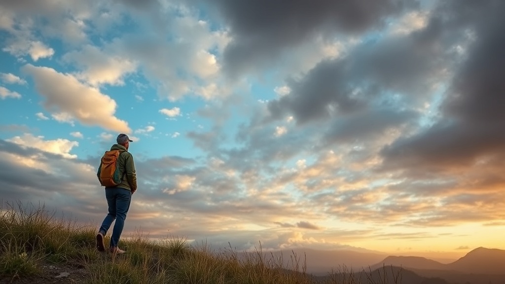
Reading the Clouds for Safer Afternoon Hikes

Have you ever been halfway up a trail only to see the sky turn a bruised shade of purple and realize you're trapped in a valley with no way out? This post covers how to identify different cloud formations, understand how they signal incoming weather, and how to make the call to turn back before a storm hits. Understanding the sky isn't just a hobby—it's a survival skill that can save you from lightning strikes or flash floods during an afternoon hike.
How do I identify storm clouds before they hit?
The quickest way to spot an approaching storm is to look for Cumulonimbus clouds, which are tall, dense, and often have a flat, anvil-shaped top. These are the heavy hitters of the sky. While a few white, puffy Cumulus clouds are usually harmless, they can transform rapidly into something much more dangerous if the atmosphere is unstable.
Keep an eye out for these three specific stages of cloud development:
- Cumulus Humilis: These are your "fair weather" clouds. They are small, flat, and stay low to the ground. If you see these, you're likely safe for the next hour or two.
- Cumulus Congestus: These look like towering cauliflower heads. They have significant vertical growth. This is your first real warning—the atmosphere is building energy.
- Cumulonimbus: This is the final stage. The top often spreads out into an "anvil" shape. When you see this, the storm is either happening or is imminent.
It's worth noting that the wind direction often shifts right before these clouds arrive. If you feel a sudden, cool gust or a drop in temperature, the storm is likely pulling air up into its base (a process called an updraft). Don't ignore that chill.
For more technical details on how these systems form, the Wikipedia entry on Cumulonimbus offers a deep dive into the physics of vertical development. It's a lot of science, but the visual cues are much simpler to track in the field.
What are the warning signs of a lightning strike?
The most immediate sign of an impending lightning strike is a sudden darkening of the sky accompanied by a rapid drop in temperature and an increase in wind speed. Lightning is unpredictable, but certain atmospheric patterns tend to precede it. If you see "virga"—streaks of rain that look like they are evaporating before they hit the ground—it means there is high tension in the air. This often precedes heavy downpours and electrical activity.
I always tell people to watch the light. If the light becomes "flat" or eerie, and the clouds look heavy and dark at the base, the risk of lightning is high. You shouldn't wait for the first crack of thunder to seek shelter. By the time you hear it, the strike could be seconds away.
If you find yourself caught in the open, you need to act. This isn't the time to fumble with your gear. Here is a quick hierarchy of safety:
- Get off the ridge: High points are lightning magnets. Move to a lower elevation immediately.
- Avoid isolated trees: Don't stand under the tallest tree in a clearing. It's a common mistake that leads to disaster.
- Get away from water: Streams and lakes are highly conductive. If you're crossing a river, move to higher ground.
- Drop your gear: If you're carrying metal trekking poles or a metal-framed backpack, set them aside a few feet away from you.
I've seen plenty of hikers freeze up when the sky turns dark. Don't be that person. Movement is your friend—get low, get downwind, and get away from high points.
How much does weather gear actually matter?
The quality of your gear determines whether a sudden rainstorm is a minor inconvenience or a dangerous hypothermia risk. While a cheap plastic poncho might keep you dry for ten minutes, it won't protect you from the wind and sustained rain of a mountain storm. You need breathable, waterproof layers that can handle high-output movement.
When I'm prepping for a hike in the New Brunswick woods, I don't just grab any old jacket. I look for specific technical specs. A "water-resistant" jacket is not the same as a "waterproof" jacket. One sheds a light drizzle; the other survives a deluge.
| Gear Type | Best Use Case | Protection Level |
|---|---|---|
| Water-Resistant Shell | Light mist or light wind | Low |
| Standard Rain Jacket (e.g., Patagonia Torrentshell) | Steady rain and moderate wind | Medium |
| Technical Hard Shell (e.g., Arc'teryx Beta) | Heavy storms and high wind | High |
| Emergency Bivy/Space Blanket | Survival only (extreme cold/wet) | Minimal/Emergency |
The catch? Technical gear is expensive. But you're paying for the membrane technology that allows sweat to escape while keeping rain out. If you wear a non-breathable plastic raincoat during a steep ascent, you'll soak yourself from the inside out with sweat before the rain even starts. That's a recipe for a cold, miserable afternoon.
You can check the Government of Canada weather service for official forecasts, but remember: local microclimates can change much faster than a digital forecast can update. Always check the radar, but trust your eyes more.
If you see the clouds building, don't wait for the app to tell you it's raining. The clouds are the real-time data. If the vertical growth is visible, the storm is already working its way toward you. It's better to be a little frustrated that you had to turn back early than to be stuck shivering on a ridge while a thunderstorm rolls in.
One thing to keep in mind is the "valley effect." Sometimes, a storm might look like it's passing over a peak, but it can actually get "trapped" in a valley, leading to much heavier rainfall than the surrounding areas. If you're hiking in a deep drainage or a canyon, be extra cautious. The water has nowhere to go but down, and you're at the bottom of that path.
Always carry a lightweight, high-quality shell in your pack, even if the morning looks perfect. The weather in the outdoors is never a guarantee. It's a variable you have to manage, not a constant you can rely on. If the sky starts looking like a bruised plum, it's time to head for the trailhead. Your future self will thank you.